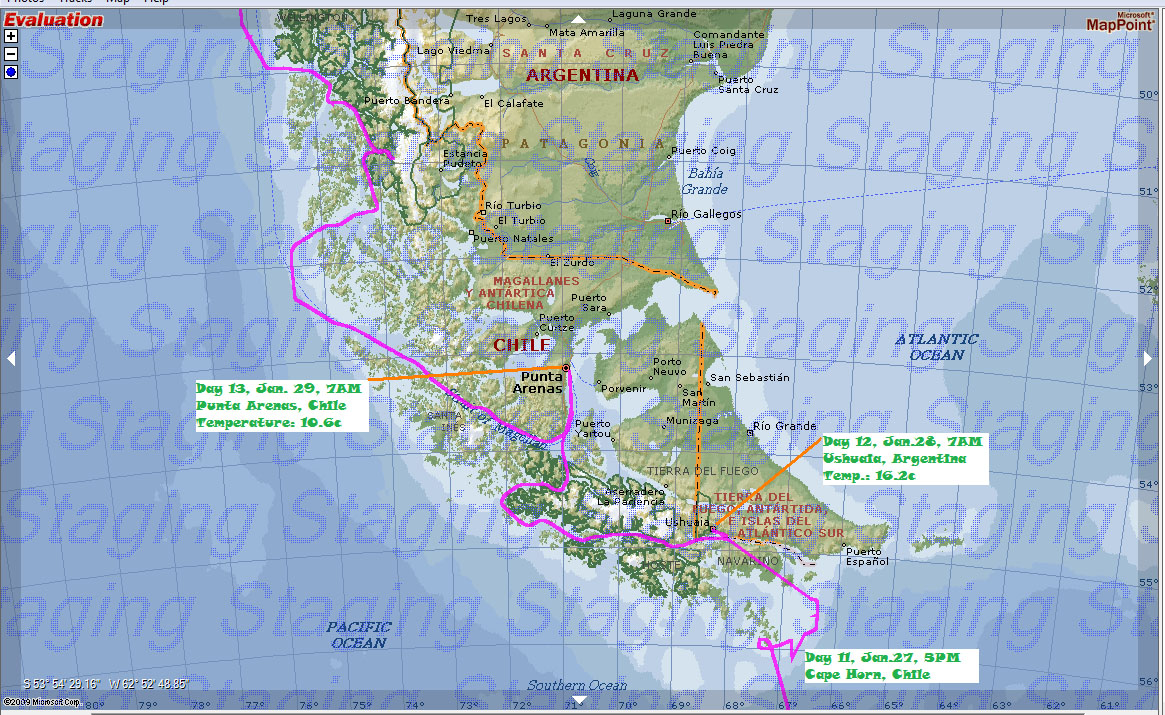
Patagonia is a geographic region containing the southernmost portion of South America. Located in Argentina and Chile.This is the GPS tracks of where the ship travelled in the region.
We visited Cape Horn, Chile, Ushuaia, Argentina, famous Beagle Channel, and Punta Arena, Chile before our final destination, Santiago, the capital city of Chile.
一月26日22点44分,公主号穿越了南纬60度线,正式离开了南极水域。
巴塔哥尼亚是南美最南的地理区域,包括了部分阿根廷和智利领土。下面是公主号航行的GPS纪录。
我们用了五天的时间从这个区域最南端(南纬55度)的合恩角(智利),经过了著名的毕哥水道,最后到达南纬33度的智利首都,圣地亚哥。其间停靠了世界最南的城市乌斯怀亚(阿根廷),智利的蓬塔阿里娜。
 |
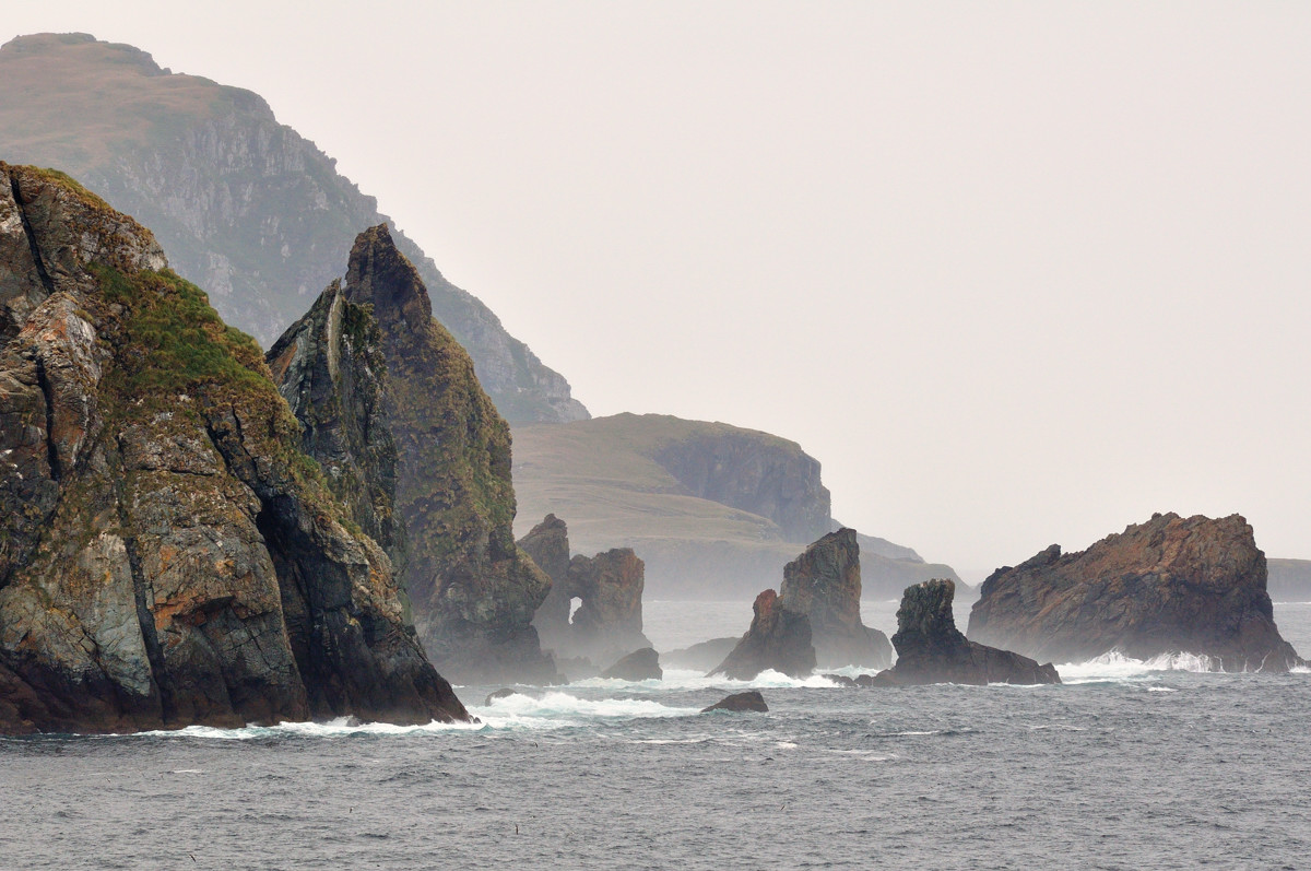
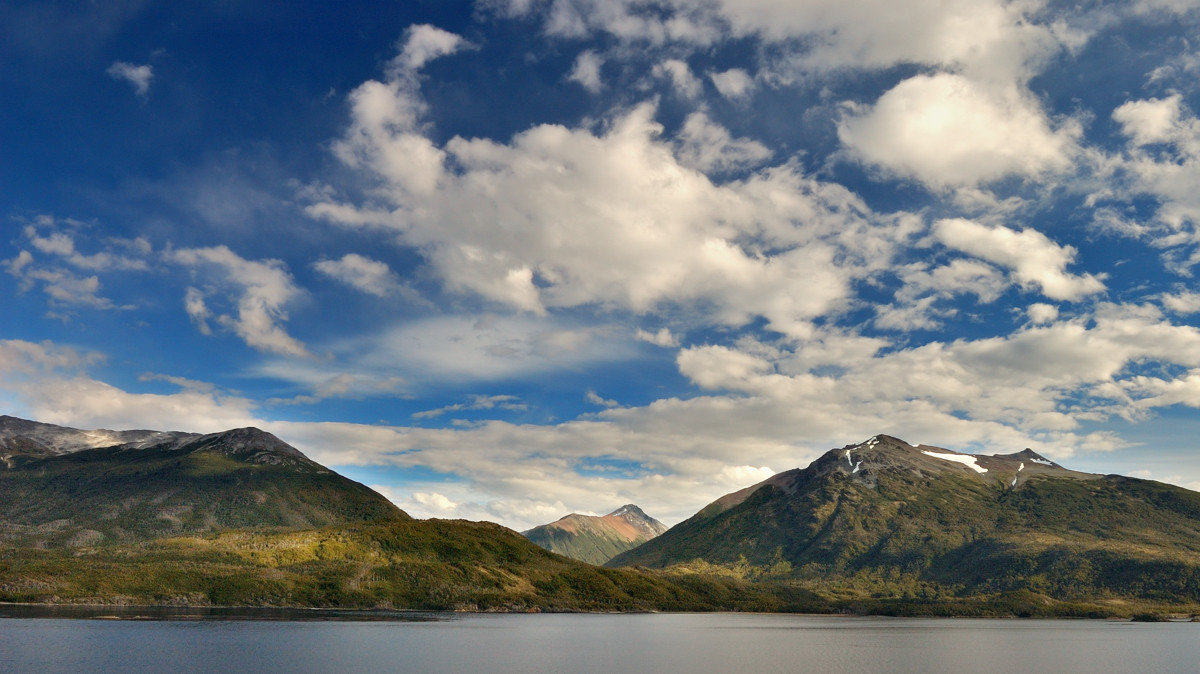
On Jan. 27, Star Princess maintained her Northerly heading for most of day , until 1700 where we finally reached Cape Horn, Chile, the most Southern tip of South America.
一月二十七日,公主号在经过几乎一整天的向北航行后,于下午5点到了南美的最南端,合恩角。
Cape Horn - the most southerly point of South America
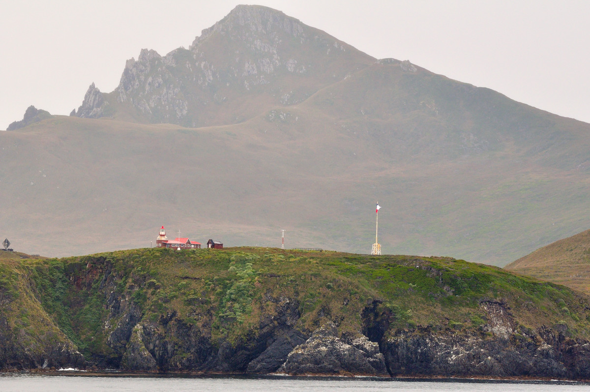 |
For many years Cape Horn was a major milestone on the traditional route, by which sailing ships carried trade around the world. However, the waters around the cape are particularly hazardous, owing to strong winds, large waves, strong currents and icebergs; these dangers have made it notorious as a sailors' graveyard.
很多年来,合恩角一直是一个连接东西方贸易航行中的一个重要里程碑,这里的水域以恶风巨浪,湍急的水流和浮冰而成为著名的水手坟墓
 |
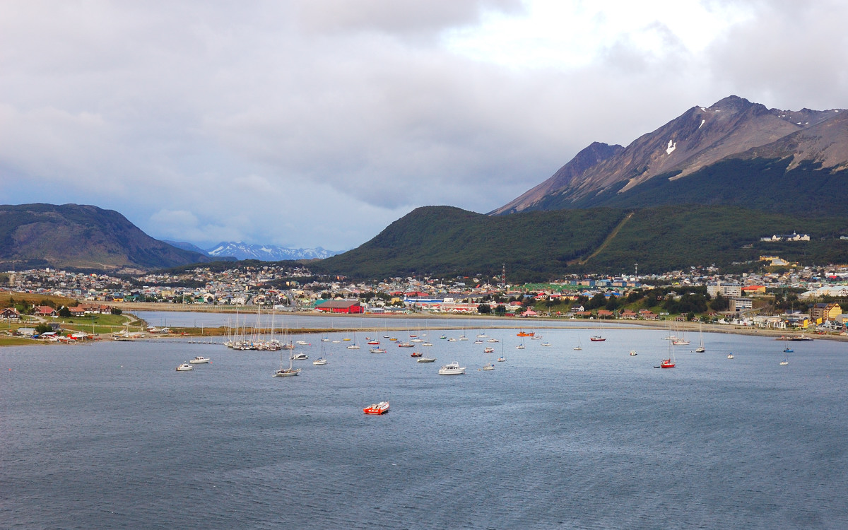
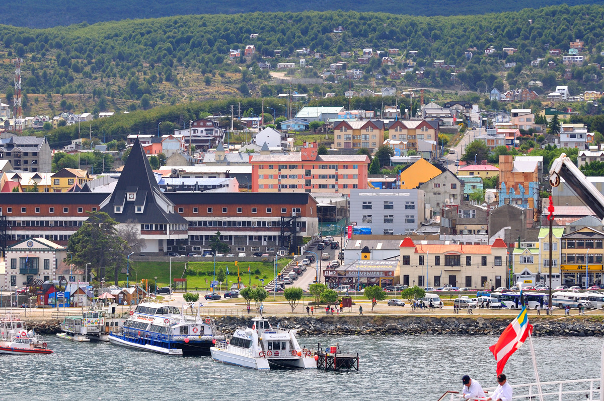
Ushuaia,Argentine - the southernmost city in the world。Magellan called it Tierra del Fuego, "the Land of Fire", having seen flames rising from the darkened islands. For over three centuries, the name struck fear in the hearts of mariners. Howling head winds, mountainous seas, and rocky coastlines spenlled a sudden end to many voyages. Today, Ushuaia is a key access point to the southern regions; it receives regular flights from Buenos Aires at Ushuaia International Airport. The city itself is a popular vacation spot for people from Buenos Aires. Flights are also available from Santiago, Chile. The city population is estimated today at about 64,000。
乌斯维亚,著名的葡萄牙探险者,麦哲伦把它称为“火之地”,就像看到火焰从黑暗的岛上升起。三个世纪来,这个曾使航海者惊心胆战的地方不知道让多少人在这里险恶的航行环境中丧生。今天,乌斯维亚,成为区域的重要门户,从这里有飞往布宜诺斯艾利斯和圣地亚哥的定期航班。这里也是布宜诺斯艾利斯人的理想度假地。当地月有六万四千个居民。
 |
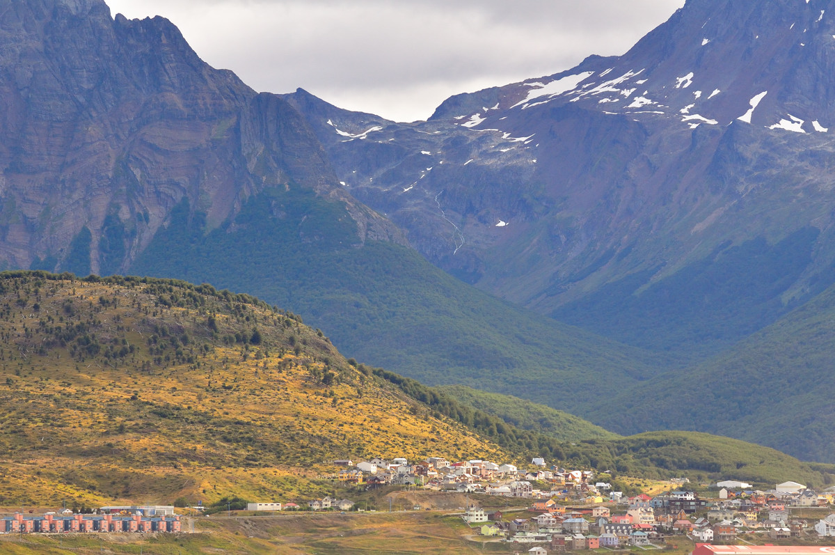
Ushuaia,乌斯维亚
 |
Ushuaia,乌斯维亚
 |
Ushuaia,乌斯维亚
 |
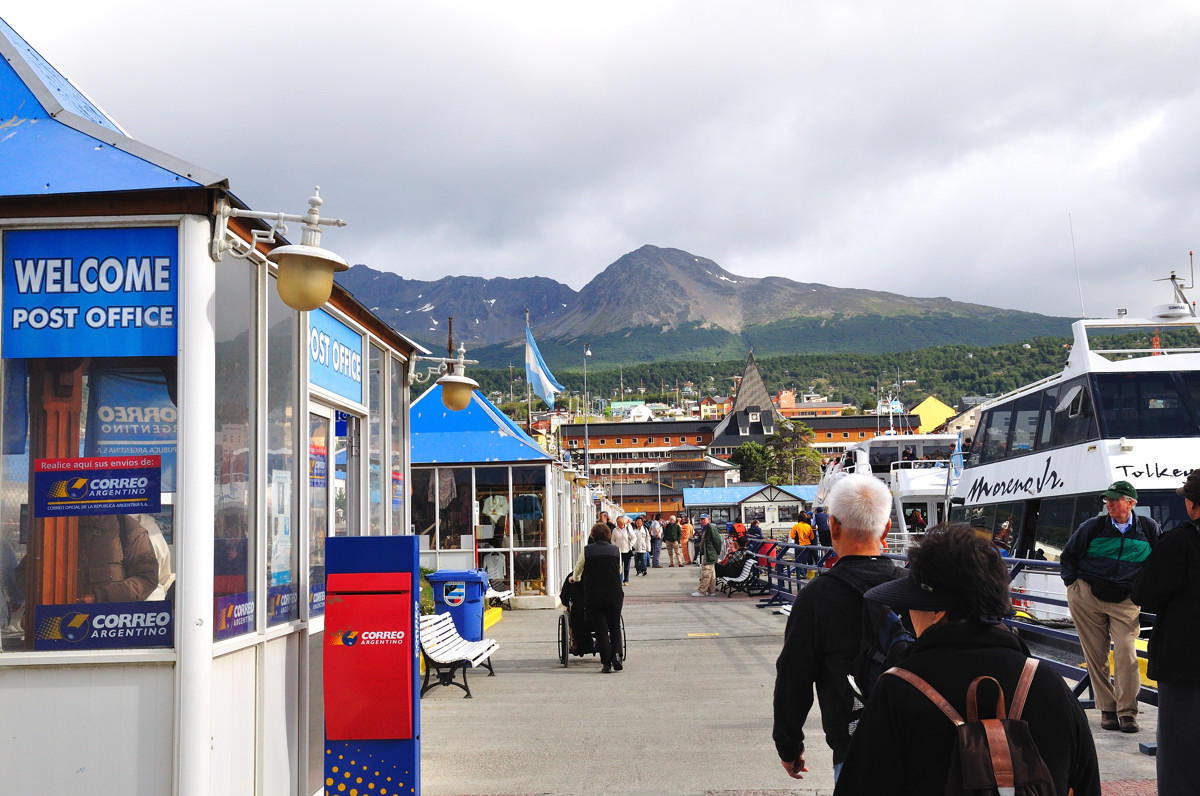
Mails from post offices in Ushuaia will receive a "the end of world" stamp,从乌斯维亚邮寄的信件会有个“世界末端”的邮戳,邮票+明信片才7个比索($2美金),不过在过了近一个月后收到的明信片只盖了半个模糊的邮戳!
 |
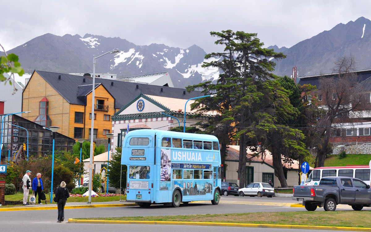
Ushuaia - the southernmost city in the world,城市街景
 |
巨大的海鸟从甲板上飞过。
 |
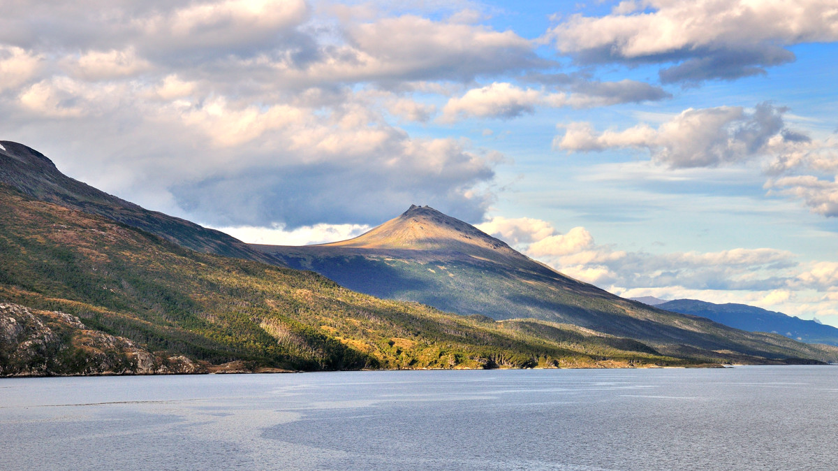
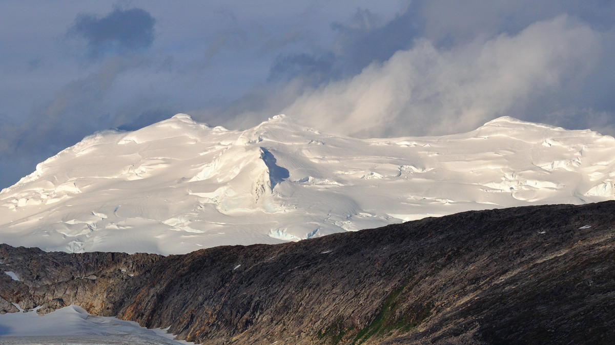
大约下午4点半,公主号离开了乌斯维亚沿毕哥水道西行。这里天很蓝,云很低
Beagle Channel
 |
Looks like Fuji mountain in winter,冬季貌似富士山
 |
Beagle Channel。1,
 |
Beagle Channel。2,天很好,正好今晚看点都在右舷,我们就拿了晚餐的食物坐在船舱里边吃边看,阳台很大为啥不去?太冷!不过,拍照还是要到阳台上去。
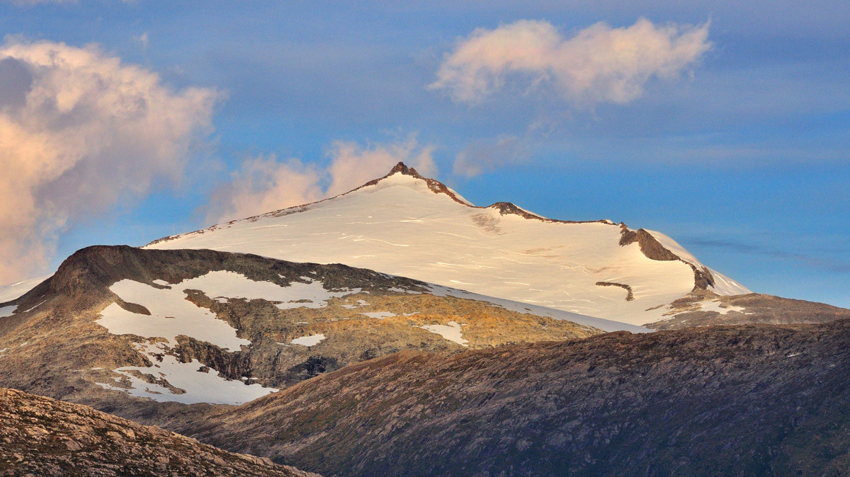 |
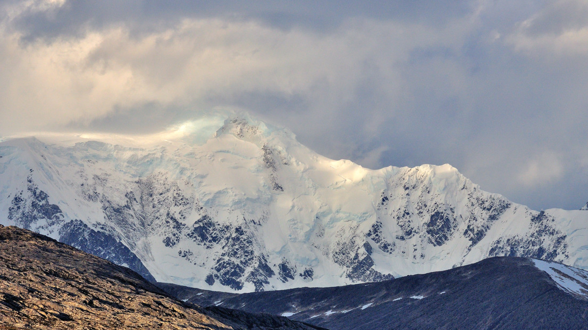
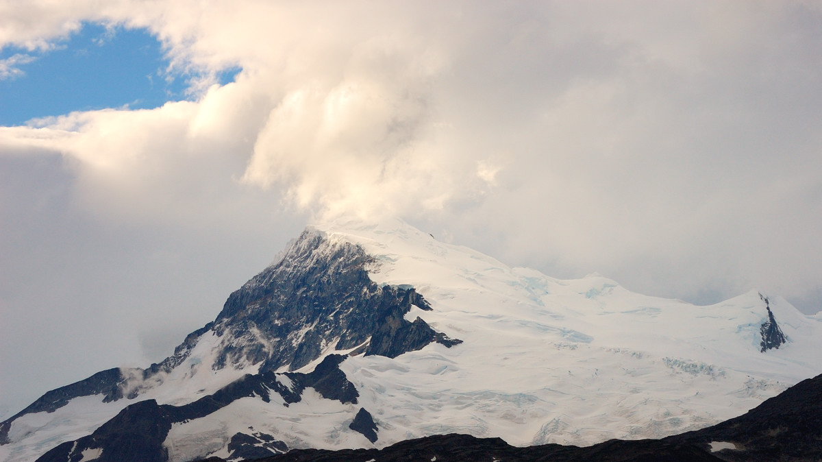
Beagle Channel。3,傍晚斜射的光线很好,把冰山上积雪的层次皆显现了出来
 |
Beagle Channel。4,一团团掠过的云彩给冰雪覆盖的山顶带来了几分神秘
 |
Beagle Channel。5,一眨眼,又是碧蓝的天
 |
Beagle Channel。6,夕阳下,积雪和冰川呈现出不同的色彩
 |
Beagle Channel。7,随着船的移动,积雪和冰川变化着角度和色彩
 |
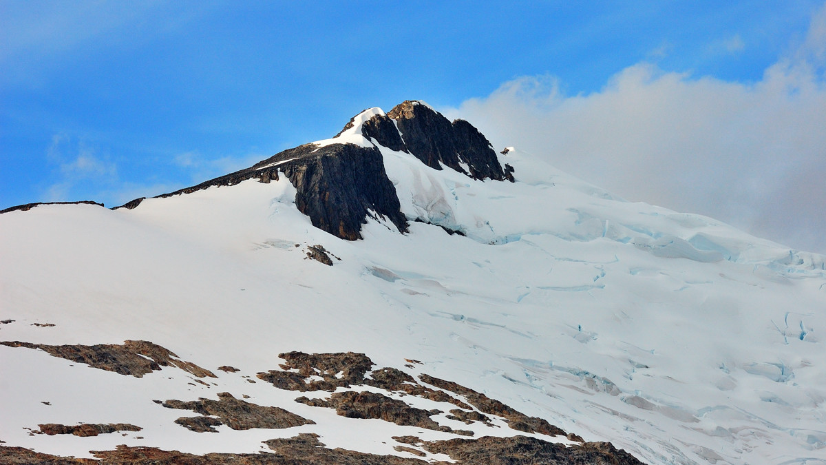
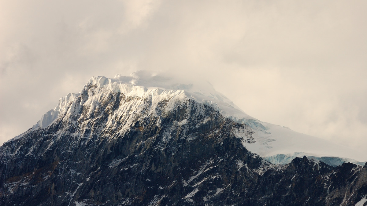
Beagle Channel。8,一面是山,一面是雪
 |
Beagle Channel。9,拉近了看
 |
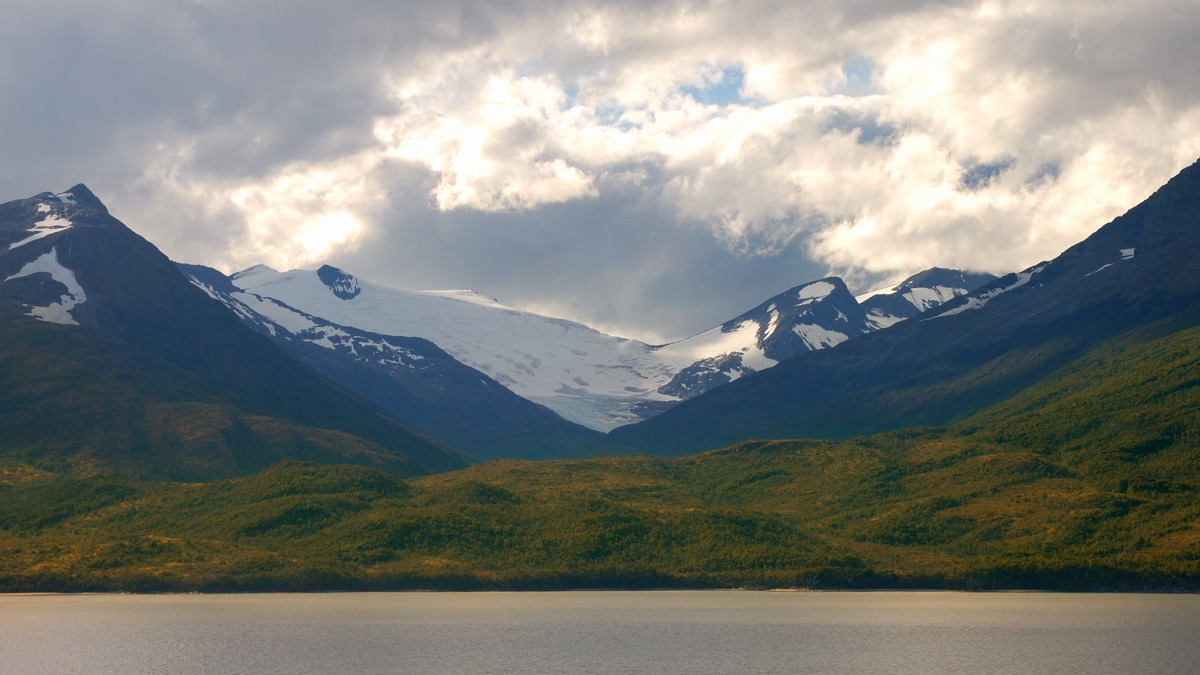
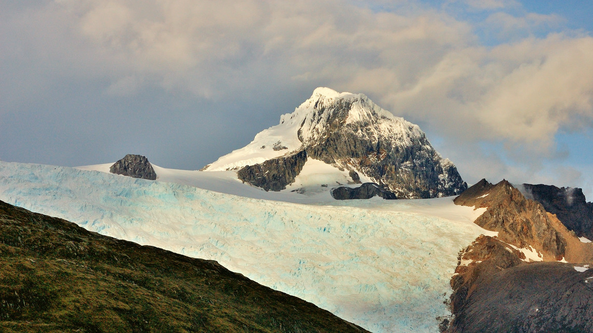
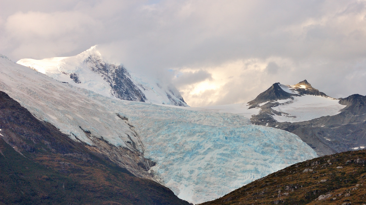
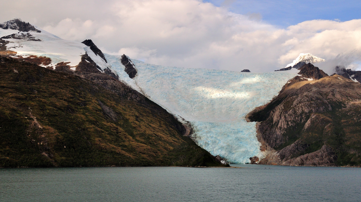
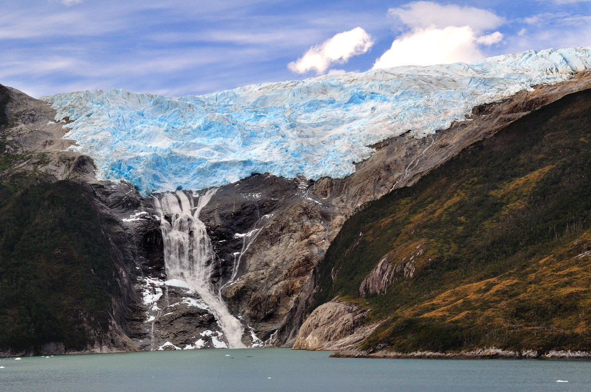
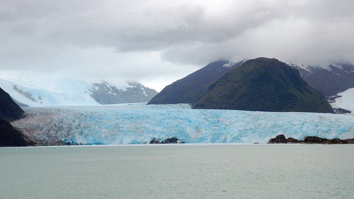
Glacier at Beagle Channel,比格水道以积雪冰川出名,每个冰川以不同的欧洲国家命名,这个是意大利
 |
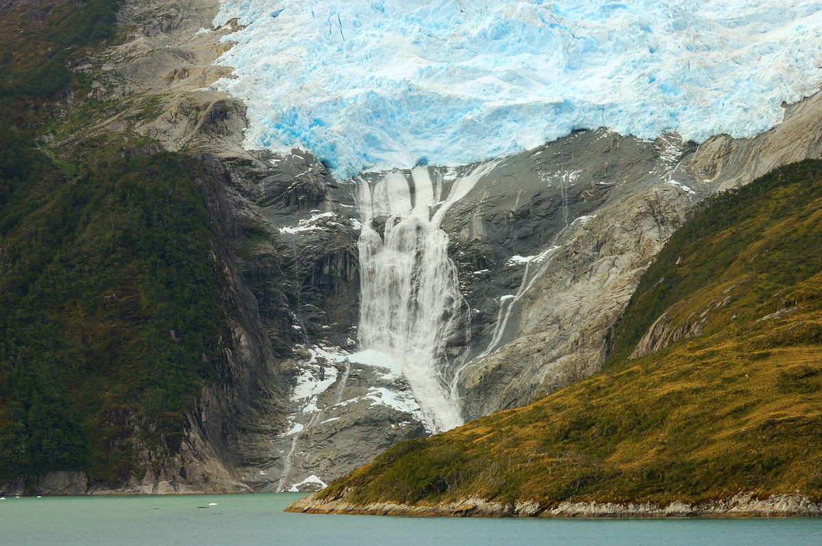
Melting glacier, Beagle Channel,这个是非常罕见的冰川瀑布!忘了是以哪个国家名字命名的了
 |
Melting glacier, Beagle Channel,相信这个冰川冬天还会回来。
 |
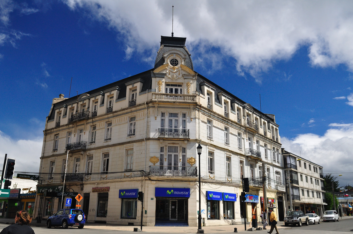
Punta Arena, Chile,蓬塔阿里娜是麦哲伦海峡的一个最主要的聚集地,在巴拿马运河(Panama Canal)开通以前,麦哲伦海峡是从大西洋到太平洋商船的必经之地。如今,蓬塔阿里娜是巴塔哥尼亚(Patagonia)第三大城市,人口12万.
Punta Arena, Chile,街景
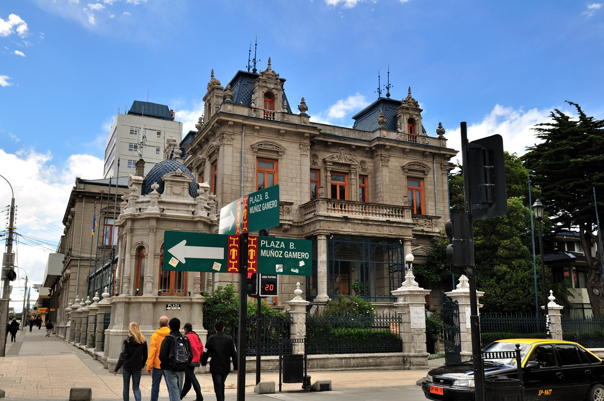 |
Punta Arena, Chile,街景
 |
Municipal Cemetery, established in 1894,很有名的城市墓地,里面的绿化修剪得非常整齐,规模也和布宜诺斯艾利斯的La Recoleta的墓地类似。不过这里埋葬的多是富裕的平民或葬身大海的船长
 |
Amalia Glacier, Chile, is about 1km wide and 40m high. Amalia冰川一公里宽40米高,也许是看多了南极硕大的浮冰和永恒的冰川,还有比格水道华丽的积雪,Amalia冰川在我看来很普通,也许是阴沉的天气,也许,当一轮神奇的阳光映射下,她才会显出和她名字一样的美丽把...
 |
Valparaíso is located in central Chile, 120 km (74 miles) to the northwest of the capital Santiago. Approximately 50 international cruise ships call on Valparaíso during the 4-month Chilean summer. The port of Valparaíso is also an important hub for shipping of container freight, and exports of wine, copper, and fresh fruit.
Travel between Valparaíso and Santiago currently takes about 80 minutes on a toll road.
二月二日,公主号到了这次航行的终点站Valparaíso。Valparaíso位于智利中部,离位于东南面的智利首都圣地亚哥约120公里。每年夏天的四个月里,大约有50艘国际邮轮会停靠这里,同时,这也是一个重要的集装箱港口,出口大量的葡萄酒,铜和新鲜水果。从Valparaíso到圣地亚哥开车约80分钟。
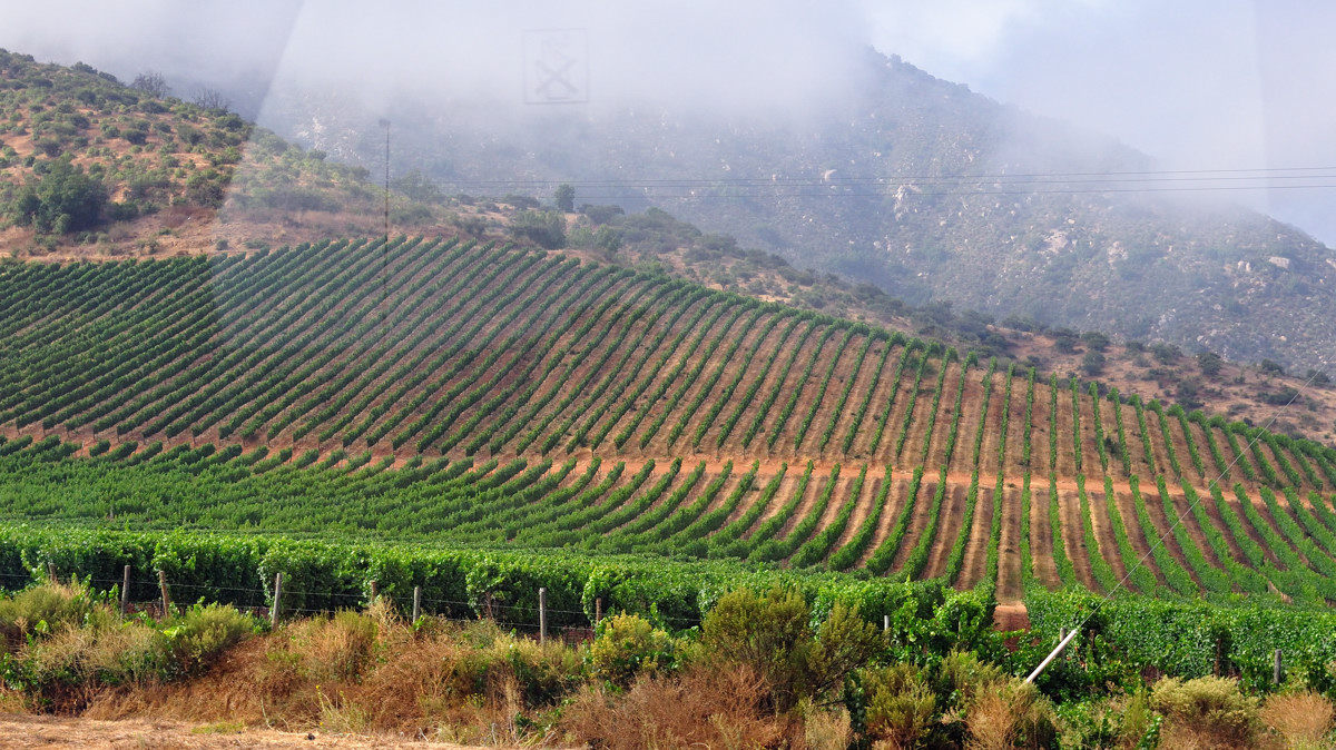
离Valparaíso很近的Casablanca Valley是智利新兴的葡萄酒产地,盛产Chardonnay和Sauvignon Blanc葡萄。
Vineyard in Casablanca Valley, Chile
 |
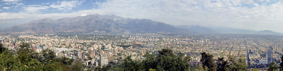
Santiago lies in the center of the Santiago Basin, it has a mild Mediterranean climate: relatively hot dry summers (November to March) with temperatures reaching up to 35 degrees Celsius on the hottest days; winters (June to August) are about 3 -15 degrees Celsius, occasional snowfall occurs in the city. According to an estimate from 2009, Santiago has a population of 7.00 million people.
圣地亚哥位于圣地亚哥盆地的中部,有着类似亚地中海的气温,夏季干燥最高可达35度,冬季在3-15度之间,偶尔会有降雪。到2009,圣地亚哥约有七百万人口。
Santiago Chile
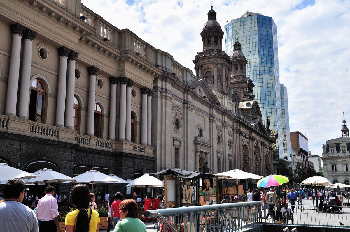 |
Santiago Chile
 |
Overlook the city, Santiago Chile,圣地亚哥全景,因为是盆地,夏天这里的空气总不是那么清澈
 |
No comments:
Post a Comment